


AllianceBernstein (AB) has teamed up with the National Center for Disaster Preparedness at the Columbia Climate School (NCDP) to launch the updated version of a climate hazard risk toolkit for US investors.
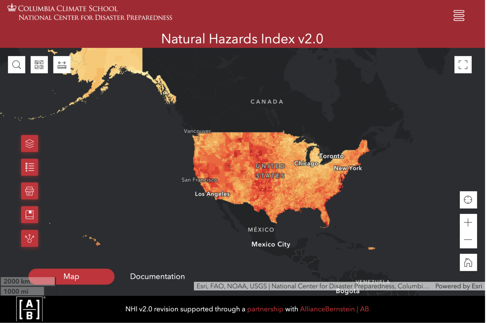
The Natural Hazards Index 2.0 is a free online dashboard tool that shows the risks of 14 different natural disasters materializing in any given city in the US including Puerto Rico.
Unlike most hazard maps, which focus on a single disaster, the Natural Hazards Index analyzes up to 14 hazards and ranks their risk from low, very low, moderate, high to very high, scoring them from one to five. The heat map uses publicly available hazard data; its map application explains each data source, the value interpretation as well as layer sources, indicators and geographic coverage.
Climate change presents material investment risks, as well as opportunities, for wealth managers and is increasingly seen as a financial risk. The US alone has battled 348 weather and climate disasters since 1980 where overall damages and costs reached or exceeded $1bn, according to the National Centres for Environmental Information, costing $2.51trn.
AB first backed the Columbia Climate School – thought to be the first purpose-built school in the world to focus exclusively on tackling climate change – in April 2021 when it became a founding member of the corporate affiliate programme associated with the school.
John Huang, director of ESG data and technology at AB, said: “The Columbia Climate School continues to be a critical partner in supporting our investment teams’ efforts to integrate material climate factors into the investment process, where applicable.
“This innovative tool represents AB’s differentiated approach to partnership and data, layering on our internal insights as an active manager when it comes to understanding the potential impact of climate change on asset values and cash flows.”
Jonathan Sury, senior staff associate and project lead at NCDP, added: “Since the launch of version 1.0 of this map, we have been impressed with its utility and depth of reach across many sectors and communities. Through this partnership, we are thrilled to be releasing this major upgrade.
“We have thoughtfully curated the most current publicly available hazard data and compiled them into an easy-to-understand format, taking the guesswork out of navigating complex data from multiple sources.”